30 All-Union route through the mountains to the sea. The legendary “thirty”, or how we walked through the mountains to the sea. more information about discounts: Discounts in the reserve

What happened in those tragic days on the thirtieth tourist route?
This question can best be answered today, decades later, by Ivan Vasilievich Bormotov, Associate Professor of the Department of Economics and Management at the Maikop State Technological University, who personally took part in the rescue operations of those very tourists, as the head of the rescue team. Ivan Vasilyevich also attended sessions of the regional court and listened to court proceedings in this case.

Here is an excerpt from I.V. Bormotov’s book, which describes these events.
It was an ordinary group of planned tourists, made up of residents of Ukraine, Uzbekistan, Central Russia and other parts of the country and who came on vacation on tourist packages. They stopped at the Khadzhokh camp site “Gornaya”, lived there for five days, went on a training trip to the Rufabgo waterfalls and moved to the camp site “Caucasus”.

An experienced tourism instructor, Alexey Pavlovich Ageev, a school teacher from the village of Tabachny, Maykop district, worked with them for all five days. Two students of the Donetsk Agricultural Institute, Alexey Safonov and Olga Kovaleva, were assigned to help him.
Alexey Ageev was unable to go on the main difficult trek through the high mountain zone to the Black Sea; the school year was beginning, and he had to go to work. All three groups of tourists: “Nolikov”, “Ashnikov” and “Beshnikov” - were divided into two subgroups and the students who came to work as instructors for the first season were appointed as leaders.

On the morning of September 9, tourists, having received food at the Caucasus camp site, set out on the main route: Caucasus camp site - Teplyak shelter - Fisht shelter - Babuk-aul shelter - Solokh-aul shelter - Dagomys village. We walked along the left bank of the Belaya River to its confluence with the Teplyak River, where there was a shelter of the same name.
Here, readers have many questions. It should be noted that the Tepljak shelter is not marked on existing maps. “Teplyak” is a little-known shelter, since the version of the route passing through it existed for only one year back in 1975. The Teplyak shelter was closed after the tragedy of 1975. The route again began to pass along the Zhelobnaya River, through the Partizanskaya Polyana and the Armenian shelter. .
In the evening, a festive dinner was organized around the campfire. It has already become a tradition on many planned routes - when there is no reason to drink, they invent one. So it was this time. They played a comic camp wedding, Honeymoon And romantic trip. Usually such holidays began at the beginning of the route and ended cheerfully in Dagomys’s restaurant at the end of the route. People are on vacation, they have been preparing for it for a whole year.
The late rebound, as usual, led to a late rise. The weather was cloudy. For two days now, gray heavy clouds had been rolling in from the southwest.
On the morning of September 10th we were delayed in getting on the route. While we prepared breakfast and collected our backpacks, we lost two or three hours of morning walking, when the weather still allowed us to go through the most difficult and steep part of the route. It was cloudy in the morning. The path in the dense fir forest climbed steeply up the slope. A light drizzle of cold rain began, and the path became slippery.
The closer we got to the alpine zone, the colder it became. There was a smell of snow in the air - this was the first sign of an approaching hurricane. Dampness and cold permeated the entire body. Snow pellets began to fall. The forest was somehow unusually calm. And the snow charge did not alert the instructors. The groups entered the alpine zone and stretched out in a long chain along the eastern slopes of Mount Guzeripl. The slopes of the Kamenny More ridge, Mount Oshten and the top of Mount Guzeripl were white with snow, but this did not cause alarm among the instructors. A strong wind blew in gusts of rain and then a load of snow pellets. The tourists, dividing into several small groups, moved along the trail, traversing the slope of Mount Guzeripl.
The bad weather was getting worse. The snow pellets turned into a continuous blizzard. In a matter of minutes the path was swept away. There was only white ahead alpine slope. Visibility was reduced to 2-3 meters. Even experienced tourists difficult to navigate in conditions of limited visibility. The instructors tried to gather the tourists, stretched along the path along the slope, all together into one group. Safonov managed to catch up with Kovaleva’s group and unite. They began to consult with the group on what to do next: either return to the shelter, or make their way along the path forward to the Fisht shelter. The instructors' uncertainty was immediately conveyed to the tourists.
Opinions were divided. Some insisted on going forward to the Fisht shelter, others insisted on going back, and still others insisted on going down into the forest and waiting out the bad weather. The blizzard was in full force, the wind was knocking down, the snow made it difficult to move, cut my face and hands, and completely hid the path and landmarks.
When the instructors decided to go back and began to collect tourists who had lost their way to go to the shepherd’s booth, other adjustments had already been made to their teams. Among the tourists there were clear leaders - healthy, strong guys with army and camping experience. The group always listened to their opinion; their authority was higher than that of young students.
They were the first to leave the path towards the forest, which was no more than half a kilometer away. The wind was blowing at our back, the forest was below, and walking seemed easy. Other tourists rushed after them. No one paid attention to the instructors’ cries to return to the trail.
Cold, snow and wind drove them to the saving forest. From that moment on, they were left alone with the elements. Kovaleva, having gathered the remnants of the group, led her to the shepherd's booth. Safonov followed the tourists down, trying to collect the tourists who were scattering along the slope. But panic had already begun. Someone threw their backpack and ran down the slope, someone shouted, urging them to walk together and not abandon each other, someone, stuck in deep snow, asked for help. The group was driven by one panic thought: “Hurry down to the saving forest, there’s a fire there, it’s warm there,” and they fled, abandoning their weakened comrades. A gust of wind helped them, drowning out their voices, hitting them sharply in the back, pushing them into the deep crevice of the Mogilnaya gully, one of the tributaries of the Armyanka River.
The “leaders” who split the group still managed to enter the forest and light a fire. Whoever had the strength to make his way to the fire made it through and remained alive. The rest, exhausted and lost in the snowstorm, scattered along the steep slopes of the Mogilnaya ravine.
For a long time, the healthy and strong guys sitting around the fire heard prayers and requests for help from the dying. No one got up from the fire, went to the rescue of their comrades, or helped the weakened get out of the ravine in the deep snow. So the tourists, who left the trail and rushed after the leaders, were left abandoned on the mountainside alone with the elements.
Meanwhile, Olga Kovaleva safely reached the shepherd's booth with the remnants of the group. The ice pellets cutting her face and eyes made her blind. Safonov managed to gather some of the tourists on the slope, cross the Mogilnaya beam stream, enter the forest and light a fire. He ordered the tourists to collect firewood, keep the fire going, and he himself went to look for the others who remained on the slope. None of the men could tear themselves away from the fire and went with the instructor to look for the stragglers.
And when he returned, leading the half-frozen girls with him, the fire was no longer burning - there was no wood. The men sat huddled close to each other and froze. With great difficulty, the instructor managed to force the tourists to collect firewood and relight the fire. Nobody wanted to go get firewood. But when the fire started burning, the men were the first to snuggle into the warmth, not letting others in. They pushed away weaker people and women, snarling and making scandals.
Olga Kovaleva, in a shepherd’s shed, met the shepherds Vitaly Georgievich Ostretsov and Vladimir Extreme, who were grazing the cows of the “Path to Communism” collective farm, and asked them to help find the tourists scattered on the mountainside. They immediately got dressed and went out to search. When Ostretsov, exhausted, dragged two girls to the booth and asked the guys to help pull another girl out of a deep beam, who had lost consciousness, there were no volunteers. He carried her as far as he could, up to his chest, getting stuck in the snow. On the way, he met two more tourists sitting under a large fir tree, and ordered them not to go anywhere and to lift the unconscious girl from the beam, saying that he would come for them.
With great difficulty, he drove the healthy guys out of the warm booth so that they could follow his trail in the snow and pick up the girl and two tourists who remained under the fir tree. But the guys, moving away from the warm place, stood there for a while and returned to the booth, saying that they had not found anyone.
The girl, left in the beam, was left to freeze, no one came for her. The fate of the two left under the fir turned out like this. They turned out to be tourists Svetlana Vetrikush and Mikhail Osipenko. Svetlana, firmly confident that she would still be helped, that they would come for her, that they would know about her, fought alone against the elements for three days and survived. She survived with hope and faith that someone would get through to her. Dripping wet, without warm clothes, matches, fire or food, she built herself a hut under a huge fir tree from branches and ferns. It made a path around the fir in the deep snow, and kept moving, not allowing itself to freeze.
On September 13, as soon as she saw the rescue helicopter, she left her shelter and, silently crying, began to climb the scree slope towards the rescuers. She is the only one whom the rescuers managed to find alive; she did not lose her composure and bravely fought the cold and hunger. I waited all the time. I waited three days. She could have given in to panic and left the place where Ostretsov left them, then she would probably have died. She lived in hope that help would come, and survived in this element.
The mountains do not forgive weakness, cowardice and cowardice. Having just overcome all the difficulties, she scrambled with her last strength to the rescuers, screaming in a weakened voice, but did not hear her voice. Seeing rescuers rushing to her, she lost consciousness. They laid her on a tent and carried her into the helicopter.
Mikhail Osipenko, who was with Svetlana, decided to find his abandoned backpack. It contained warm clothes, food and dry matches. He walked away from the fir tree where Svetlana was staying and got lost in the forest. Together with a group of rescuers, we found him as the last of the dead. He fell into the deep abyss of the canyon and lay on the rocky bottom of the Armenian River, under a snow avalanche. To the right and left of him, drowning out everything around, the full-flowing 40-meter Armenian waterfalls roared. It was already melting under bright sun snow from a past hurricane. They found Mikhail only on the ninth day after the death of the entire group.
In addition to small groups of tourists, Safonov, Kovaleva and the “leaders”, a small group of tourists also managed to gain a foothold in the forest, the rest were left to slowly freeze in the snow. Left without warm clothes, without an instructor, having lost the will to fight the elements, they doomed themselves to freezing. Of the 53 people, 21 died.
Those who survived the first night told us how they huddled in a circle, folded the remaining backpacks, pressed back to back and sat covered with plastic wrap. By morning, four of this group remained motionless.
In the group of “leaders” events unfolded completely differently. They refused to help the weak and took warm clothes from tourists for themselves. These healthy guys, who caused confusion and panic in the group, had everything: a map, dry matches, food, medicine. They were well equipped, sat by the fire and did not pay attention to the cries of the dying. In the morning, having woken up and had breakfast by the fire, we calmly went down the path, taking with us warm clothes taken from the dying tourists.
They also survived. We were also at the trial. But they were not judged. The court explained that these looters were affected by the elements and did not know what they were doing. After the first night there were still alive, exhausted and frostbitten. They were unable to get out of the deep Grave Beam. The woman named Dina remained lying at the bottom. How she asked her strong and healthy comrades not to abandon her, to help her, for the sake of her small children, but she never asked for help. The guys, having opened the canned food and huddled next to the warm fire, calmly warmed themselves. Even when the last can of stew remained in the group, one of them opened it and calmly ate it alone, without sharing it with his hungry comrades.
The next day, September 11, full of fresh strength, the next planned group of tourists under exit number 94 went up to the shepherd booth of shepherd Ostretsov. This group was also led by students, only from the Krasnodar Polytechnic Institute Sergey Borzenko, Lyudmila Taranukhina and Galina Kuzminkina.
Seeing the frostbitten instructor of the 93rd group Alexey Safonov and the blinded Olga Kovaleva, we learned from them about the snowy situation, turned around and went down to the Teplyak shelter to prepare lunch for ourselves, without providing assistance to those in distress and without sending messengers to the camp site to warn about the loss of people in 93rd group of tourists.
The tragedy that took place on route 30 took place mainly in the forest area at an altitude of 1400-1600 meters above sea level. The bad weather raged for exactly 24 hours. During the day everything was covered with snow, at night it became sharply cold, and the next morning the first rays of the sun flashed through the breaks in the clouds. The snow immediately settled, and cheerful streams rang through the numerous grooves of the coal-black slope of Mount Guzeripl.

Excerpt from the book “In the Land of Legends and Traditions”, author I. V. Bormotov.

Today, this is the only source of information about this tragedy, so you can find many questions and discussions about this on the forums. For example. Where was the Teplyak shelter located? What was the route of Route 30 in 1975? Where was the Armenian shelter located? And other questions.

Majordomo
, 14051510500
in a group 7-8
people
12500
in a group 4-6
people
12500
in a group 7-8
people
14500
in a group 4-6
people
15500
in a group 7-8
people
17500
in a group 4-6
people
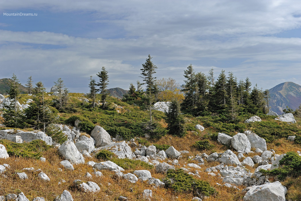
Lagonaki is unique mountainous region Northwestern Caucasus. The name “Lagonaki” denotes a highland that unites into one orographic unit a number of mountain ranges and flat-topped ridges in the area between the Belaya and Pshekha rivers: the Nagoy-Chuk ridge, the Lagonaki ridge, the Montenegro, Messo, Murzikao and Abadzesh massifs, the Azish-Tau ridge, the Stone Sea ridge and Fisht-Oshtenovsky mountain range. Along the periphery, the highland is clearly outlined by steep, sometimes steep slopes. The highlands are composed of a thick layer of Upper Jurassic limestone, in which karst landforms are widely developed: caves, sinkholes and wells, karst valleys.


In the scientific literature, as well as in local history publications, one can find different definitions of Lagonaki, its area and borders. Sometimes only ridges with mountain-meadow vegetation located north of the Pshekha-Su and Oshten peaks are combined under this name. There is even a statement that the Lagonaki plateau is a basin between the Murzikao massif and the Stone Sea ridge.
A number of tourist routes are laid through the Lagonaki highlands, the most famous of which is, perhaps, the Thirtieth route or “thirty”.
Features of the route
The Lagonaki Highlands can be visited from the end of May, but best time for the Thirtieth Route - the second half of June, July, August and September, when the alpine meadows are free of snow, the subalpine tall grass does not interfere with walking, overnight stays at altitude are not so cold and you can even swim in mountain lakes. At the end of September, the first snowfalls are already possible in these places, which briefly decorate the shores of the lakes and trees in the valley, only to melt later. The beginning of October is the time of golden autumn in these places, but at the same time in the highlands you can find yourself at the beginning of the real winter.
Hiking along Route Thirty can take four days or more. But it is better to plan 4-5 days for this trip: during this time you can visit all the most interesting sights of Lagonaki and the surrounding area.
“Route Thirty” is not technically difficult and is accessible to almost any traveler.
For travel Need the following camping equipment:
- backpack (volume not less than 60 l)
- rug
- sleeping bag (preferably with a comfort temperature no higher than +5°)
- tent
- trekking poles
- flashlight
- set of utensils (mug, spoon, bowl, knife).
At the end of September and beginning of October, frosts are possible at night, so you will need warm clothes.
When packing your backpack, don't forget leave some space in it for food (which the guide will buy and distribute to you)!
additional information
Deadlines
June-October
Complexity
Suitable for beginners, but minimal physical fitness required
Prices
Trekking for 3 days, cost per person:
10500
in a group 7-8
people
12500
in a group 4-6
people
Hiking for 4 days, cost per person:
12500
in a group 7-8
people
14500
in a group 4-6
people
Hiking for 5 days, cost per person:
15500
in a group 7-8
people
17500
in a group 4-6
people
(For a group of less than 4 people, the price is negotiable)
Included in the price
- pass to a specially protected natural area (reserve, sanctuary, national park)
- food on the route
- guide services
- first aid kit
- gas equipment
- photo report from the trip
Not included in price
- equipment rental
- medical insurance
- transfer from the airport/station to the beginning of the route (to the beginning of transfer by off-road transport)
Equipment rental
- the cost of renting a basic set of equipment (tent, mat, sleeping bag, dishes, flashlight, trekking poles) is 1200 rubles. per day per person.
- The cost of renting additional equipment (backpack, gaiters, etc.) can be found in the section.
additional information
- Participants carry tents, personal equipment (sleeping bag, mat, flashlight, dishes) and food themselves in backpacks. Setting up the camp and preparing food is carried out in turn by all participants in the hike.
- Depending on the weather conditions and the physical condition of the group, the guide may make changes to the route.
- The optimal group size is from 4 to 10 people.
“Route 30” - this hike in the Caucasus was recognized as the best hiking route in the USSR; Nowadays it has not lost any of its attractiveness for tourists of different levels and ages who want to enjoy the beauty of the Caucasus.
Hiking "Route No. 30" in the Caucasus passes along the once most famous in the USSR walking routeNo. 30 in the mountains of Adygea("thirty"). Every year thousands of tourists from all over Russia and abroad pass through it; its length exceeds 60 km.
This leisure as part of a hike along route 30 in the best traditions tourist trips- food is cooked over a fire, sleep in tents, all things are carried in backpacks. At the same time, the “thirty” hike in Adygea is quite feasible for people in satisfactory athletic shape without acute diseases or physical defects.
Hike along route No. 30 in the Caucasus begins in the mountainous region of Hadjokh, and ends in resort village Dagomys (Sochi). On a hike on route 30 in the Caucasus we will see the Kuban steppes, and alpine meadows, and coniferous, deciduous forests, and the nature of real subtropics.
Now let’s talk in detail about what the phrase “route No. 30” includes. in the Caucasus, through Fisht:
Route 30 Caucasus - 1 day:
The main gathering place for the group is the Krasnodar railway station, until 8 am. There will be a transfer from here participants of the hike "Route 30" through Maykop to the village. Kamennomostsky (another name is Khadzhokh). The instructor will meet all other participants at the final point (Khadzhokhe) from lunch to evening, since the overnight stay will be near the station.
Today, on a hike along route 30, we will explore the surroundings of the village. Hadjokh. In a 15-minute walk we will see the main highlight of these places - the canyon of the Belaya River (Khadzhokh Gorge). We will be able to admire the rumbling and raging mountain river at the bottom of the canyon, walk along shaky bridges on a hike along route 30. We will also visit the Rufabgo waterfalls. Picturesque, but not too deep, after rains they turn into raging streams of muddy water. The 15-meter "Lace" is the tallest of them. Here, in a cozy clearing on the bank of the river, we will break camping, we'll cook dinner over the fire and spend the first night hike route 30, Caucasus.
(kilometre: about 8 km)
Route 30 in the Caucasus in the area of Mount Fisht - Day 2:
In the morning we move to the Abadzesh Pass. Here is already the territory of the Caucasian Biosphere Reserve: around us are lush herbs of the alpine zone and karst sinkholes, at the bottom of some there is snow even in summer. Gradually we move through the Abadzesh pass to the Rublenny stream on a hike along route No. 30. We go out to the famous Lagonaki plateau, where we admire the three-thousander Oshten, the treeless slopes of which contrast with the green hills of Lagonaki. At a stream where you can swim, we will stop for the second night in a tent camp on the hike “Along Route No. 30.”
(climb on a hike along route 30 in the Caucasus: 330 m, mileage: 10 km)
Route 30 in the Caucasus- Day 3:
Today on a hike along route 30 We leave our tents and things in place and set off for a radial trek to Mount Oshten (2804 m). Her wild slopes in some places covered with white caps of the eternal snows of the Caucasus. It is important to leave as early as possible, because after lunch the top of Oshten is covered with clouds, which is dangerous for movement. Along the route No. 30, wonderful views of the Main Caucasian Range will open up; under your feet there will be many beautiful flowers (for example, the rarest black tulips), many of which are endemic to the Caucasus. Accommodation today according to the hiking program along route 30 In the same place. Don't forget to admire the stars, which are much brighter here than in the cities!
(elevation gain: 754 m, trekking distance "Route No. 30" in the Caucasus in Adygea: 14 km)
Route 30 through Fisht. Caucasus - Day 4:
We continue our journey along route No. 30 in the Caucasus. The morning transition will give us new beautiful views surrounding mountains and valleys of the Caucasus. Then along the Guzeriplsky and Armenian passes we will go to the Fisht parking lot on the hike "Along Route No. 30". The same thing happens here White River- already powerful and wide, and there is also a very pleasant parking place. Those who find it too little can go on a radial trek (8 km) to the small Fishta glacier on a hike along route 30 in the Caucasus. It has been preserved since the last glaciation - about 10 thousand years ago, and in the scatterings of stones you can often find a fossilized shell or ammonite. The overnight stay will be at the Fisht tourist shelter.
(height drop: 470 m, mileage: 10 or 18 km)
Caucasus, hike along route 30 - Day 5:
Today's challenge hiking route 30 in the Caucasus- conquest of the Fisht-Oshten pass. First we will approach the Caucasian mountain lake Psenodakh, which has the shape of a crescent. The lake itself is quite shallow - just above the knee, but in one place there is an interesting funnel with a depth higher than human height. Mountains Fisht, Oshten and Pshekho-Su, located near Psedonakh, are considered three brother mountains in local legends. The older brother is Fisht (2867 m), the middle one is Oshten (2804 m) and the younger “brother” Pshekho-Su (2744 m). From the conquered pass on the hike on route No. 30 we will have magnificent views of the rocky slopes of Mount Fisht and the sharp ridge of the Great Glacier. We will quickly descend from the pass to spend the night more comfortably.
(altitude gain: 630 m, altitude loss: 650 m, mileage hiking route 30 in the Caucasus: 13 km)
Route 30 Caucasus - Day 6:
Since morning on the hike “Along Route No. 30” in the Caucasus we will move on a short transition to the Circassian Pass. Along the way we will see an impressive 200-meter waterfall. Let's walk through Moonlight Glade, where V. Putin's dacha is being built. Let's admire the peak of Mount Mavrikoshka and the Circassian Pass (Caucasus), where a stele was erected in memory of those killed during the Second World War. We will spend the night at the Circassian Pass. By this time, the sleeping bag will seem much more comfortable than perhaps on the first nights!
(altitude gain: 700 m, altitude loss: 390 m, mileage hike "Along Route No. 30" in the Caucasus: 11 km)
Route 30 Caucasus - Day 7:
In the first half of the day hike along route No. 30 We have a long descent ahead of us through the beech forest, which is not called “fun” for nothing. The lower we go, the thicker and warmer the air becomes - the approach of the sea is more and more noticeable on route 30 in the Caucasus. The descent will lead us to the Babuk-aul farm. Having passed through the cordon, we leave the reserve and move towards the Shakhe River, across which a bridge has recently been restored, which will save us from the ford. We will set up camp on the bank of Shahe.
(altitude drop on the hike “Along Route No. 30” in the Caucasus: 1670 m, kilometer: 23 km)
Route 30 Caucasus, Adygea - Day 8:
Along a picturesque forest road, under the steady sound of the river, we move to the Solokh-Aul farm on route No. 30, from which it is a stone's throw to the long-awaited sea in the Caucasus. We pass the almost completely extinct village of Bzog. Near the river of the same name we will see a three-stage waterfall. Soon the magnificent canyon of the Skalisty stream will open before us on the hike "Along Route No. 30". Numerous streams and waterfalls flow down the walls of the canyon, water dust sparkles in the sun's rays. In the village of Solokh-Aul, those who wish will be able to visit the tea museum and listen to the interesting fate of the “father of Krasnodar tea” I. Koshman, and they will also be able to ride horses. From here the bus is coming to Dagomys and Sochi, to the warm waters of the Black Sea.
(altitude drop on a hike in the Caucasus "along route No. 30": 1670 m, kilometer: 23 km)
Route 30 through the Caucasus Fisht - Day 9:
The evening and night at sea will certainly be remembered for pleasant sensations. Today our hike along route No. 30 in the Caucasus is over, it’s time to part ways and return home. Those who wish can extend their vacation in beach mode.
“People often ask me: why do you need all this?
I answer: because every step I take is in the mountains Caucasus during a hike opens up unprecedented horizons and stunning beauties... Then, to feel victory when I climb to the top with my last strength... Then, that there are people with me who, in these “terrible conditions and hard physical exertion,” find, like me , relaxation and the meaning of life..."
Hi all! While new trips are just being prepared, I decided to remember the past and write about hiking through the Caucasus through the mountains to the sea. And it was back in 2008, when the creative association ProYOU went to visit relatives in Adygea with the idea of making a short trip with access to the sea.
After a short stay with relatives (to whom we will return more than once ;-)), a trip to Maykop, and hikes along the surrounding waterfalls, we found a local guide, Slava. He agreed to take us through the mountains for a small fee. And he even organized a minibus directly to the house! We probably could have walked on our own, but the new location and the presence of a reserve, as well as the prospect of resolving issues with environmental authorities ourselves, prompted us to take a guide.
Legendary All-Union a tourist route No. 30 or simply “thirty” starts from the checkpoint of the Caucasian Biosphere Reserve, passes along the Lago-Naki plateau, through the passes Caucasian ridge, and ends in Dagomys, already on the Black Sea coast.
What is so interesting about the “thirty” route? It covers several climatic zones at once - alpine meadows, Mountain peaks with eternal snow, fir forests and subtropical coastlines. There is also a nature reserve located here, and this has helped preserve unique nature, rare and unique animals, birds, plants. It is quite possible to meet bears here (in rare cases, of course) - we saw small and large tracks.
The route runs near the Oshten and Fisht mountains, from which many rivers in the region originate. Stunning scenery is guaranteed Caucasus Mountains, stormy mountain rivers, the smell of herbs, a mountain bathhouse and much more!
The route through the mountains to the sea looks like this: checkpoint of the reserve - Instructor's gap - Armenian pass - Fisht shelter - Belorechensky pass - Cherkessky pass - Babuk-Aul shelter - Solokh-Aul shelter.
Transfer to the Fisht shelter
The minibus took us to the checkpoint, from where we walked along the Lago-Naki plateau. The spaces are incredible! The trail goes through alpine meadows, every now and then bumping into streams and lakes, and somewhere in the distance a herd of horses can be seen.


From the Lago-Naki plateau the trail goes to the slope of the Mount Oshten massif, the views become more and more “vertical”))


Amazing nature! The fields are simply bursting with greenery...

Mountain Caucasian herbs

Our guide Slavik, a very cool dude, he has a special dialect, a mixture of Caucasian and Rostov)))

It’s hard to walk because you’re not used to it...

During the whole day we walked about 7 km, quite a bit, but the landscapes replace each other with kaleidoscopic speed! At the end of the day we crossed the Armenian Pass, the descent from which ended at the Fisht shelter. It is located at the foot of famous mountain on the Belaya River, one might say at its source. The pass offers stunning views of the surrounding mountains!
View from the Armenian Pass to the Fisht shelter and the Belaya River valley


The shelter is lively - there are many tents, people crowd around the kitchen, where you can order something to eat. There are some bearded men here...


Radial access to the Big Fisht Glacier
The glacier is located at an altitude of more than 2800 meters above sea level. Fisht is famous for the presence of a large number of caves, grottoes, and underground rivers. The most famous of them are the Soaring Bird Cave and the deepest cave in Russia, “White Star”. Also, Fisht is the westernmost peak of the Caucasus, which has glaciers.
We headed to all these beauties the next morning. At first, the trail slowly climbs up, then you begin to encounter very steep rocky ledges that you have to climb up. With each new ledge, more and more breathtaking views open up.
Down below you can see the Fisht shelter:

We go higher and higher to Mount Fisht, views opposite


We finally reached the glacier and walked up it a little more. People generally climb Fisht, the category of such ascent is 1B, but we didn’t intend to.
Above there are only rocks, ice and gray thunderclouds

The guide Slava took with him a funny spaniel dog. It was difficult for her to go up and it was so hot that as soon as she saw the snow, she plunged into it with pleasure and let’s ride on her back! Then I swam in the sources of the Belaya River;-) So I ran around, all wet and happy.

Shelter "Fisht" - shelter "Babuk-aul"
Our path lies further - through the mountains to the Black Sea. From the very early morning we got up and with the very first walk we crossed the Belorechensky pass, where fierce battles took place during the Great Patriotic War. This is reported by the memorial obelisk installed at the top of the pass. In general, this entire area has a rich military history, there are signs here and there, remains of trenches...

View from the Circassian Pass to the Armenian Pass. Fisht shelter in the valley

Here is another sketch map of the area of our trip:

After the Circassian Pass, the trail goes through a dense southern forest, where we stopped for lunch. Here you can already feel the subtropical climate and the proximity of the sea. Completely different plants and humidity. In general, nature is of course very different from the Altai, and even more so, Omsk I’m used to.
Here the bear passed with her cub

Then begins a long descent into the valley of the Shahe River, it is also called a fun descent. Imagine 7 kilometers just down the roots and earth)) Everything is fine, but towards the end the knees begin to behave strangely, it’s not often that such a load falls on them! Anyone who went down there will understand me :-)
Main Caucasus Range

Then you need to cross the hanging bridge over the Shakhe River, and the nearest shelter is just a stone's throw away!
The “Babuk-aul” shelter is comfortably located in a large clearing among the warm southern forest. Unlike our previous place to stay, women are in charge of everything here. You know, the atmosphere is very different - calm and tranquility. Everything is neat, tables under a canopy, excellent shower, and a stream flows right behind the “dining room”))
Shelter "Babuk-aul"

The finish line - the road to the sea in the back of a truck
Yesterday there was a very long evening with wine and songs by the fire, so the morning was sleep-deprived)) But there was nothing to do, especially since right in the morning the other guys and I agreed to chip in on the associated Gas-66 towards the sea. And we had to leave right now; we didn’t even have time to have breakfast.
And yet, everything happens for a reason and not in vain! We would need the whole day. to walk along the Shakhe River to the village of Solokh-aul. And the road is not the most interesting - mud in the forest, no surrounding views.
I am amazed at the power of the Gaz-66 - the truck easily travels straight along the river, rolling over lying trees and wet stones. In the back, of course, it shakes mercilessly! But it’s interesting all the time: either a branch will hit your ear, or you’ll jump half a meter, and you also need to have time to talk to the guys from Chelyabinsk ;-)

In the village of Solokh-aul we rested for a couple of hours and waited for the bus to Dagomys. The road to Dagomys is very breathtaking with its views, sharp turns, she constantly goes down to the sea. It was not possible to photograph all this beauty, since we are not the only ones who want to quickly plunge into the refreshing sea - a bus full of people!
That's all, our route through the mountains to the sea has ended, legendary route“thirty” through the Lago-Naki plateau, Mount Fisht, several passes and climatic zones. Then I saw the sea for the first time! It’s later, every year I go to these parts, but this was the first time, yes. It’s difficult to convey this feeling... the perfection of nature and the world around, a splendor that simply cannot be imagined...

I was also surprised by the locals who hardly bathe and say “what did I forget there?” I try to appreciate what I have every day, something that can be forgotten simply out of habit. But beauty is everywhere, you just have to look from the other side. And I encourage you to do this!
Very close to Dagomys there is a wonderful place where you can put up tents thirty meters from the sea, it is open and publicly accessible. At the same time, there are very few people there, just noise Railway at the top, but after a day you get used to it. The beach here is small pebbles and has a rather steep descent into the sea, and on nearby beach The sanatorium has a shower. All conditions for life! Strictly speaking, a tent may not be needed, it’s Krasnodar region and subtropics! I highly recommend you go to!
Group meeting place and time:
Meeting at the railway station in Krasnodar
Our guide and transport will be in the parking lot at 10:00 am. We will meet you with a “Wanderer” sign at the airport exit. We will also have your flight and telephone numbers so that we can contact you in any case.
Meeting at Krasnodar airport
Our guide and transport will be in the parking lot at 11:00 am. We will meet you with a “Wanderer” sign at the airport exit. We will also have your flight and telephone numbers so that we can contact you in any case.
IMPORTANT! Individual transfer Krasnodar > Kamennomostsky (in case of a different arrival time from the main group) is paid additionally.
Back
On the last day of the tour we will arrive in resort town Dagomys (bus costs extra). Next - independent transfer to your place of residence. If you stay on vacation in Dagomys or in the cities closest to it, we recommend buying return tickets from Sochi.
Train tickets
Most trains arrive in Krasnodar from 3:00 to 6:00. Cost from Moscow (from 3000 rubles one way). The journey takes about 22 hours.
Flights
The most convenient flight is from Aeroflot, it arrives at 8:25 and costs from 3,500 rubles one way. Flight time is about 2 hours. We advise you to search for tickets through a search site Skyscanner.
To get there together, before buying tickets, contact us and we will tell you how and what other members of the group get there.
ATTENTION! You can purchase tickets ONLY after submitting an application and confirmation by the regional manager of availability.
Accommodation:
At the camp site in 3-4-bed rooms with shared facilities (2 days).
In mountain tourist shelters we are accommodated in 3-4-person tourist tents.
ATTENTION IE! We can accommodate you with other tourists in our group of the same sex (depending on the availability of rooms/rooms/tents). If you need another option, be sure to write to us about it!
Seaside accommodation
Nine years of experience has led us to the point that every tourist independently chooses and books accommodation on the coast! It's connected with a huge amount proposed accommodation options and individual requests of each tourist. In any locality at sea you will be offered houses, apartments, hotels, just rooms! Everyone will be able to choose the appropriate option. You can also use the service Booking.com.
During the day + 15°С... +25°С, at night 0°С... +10°С. In the mountains, the weather is cool and very changeable - even at the height of summer you can experience all seasons.
Requirements for participants:
This route has no difficulty category and is designed for beginners. No special tourist preparation is required for the route, but participants must be in good physical shape. We highly recommend that you follow our recommendations for packing and DO NOT take anything extra! During the hike, participants carry their belongings independently. Additional weight (part of the products) per person is about 1-2 kg. That is, if you follow the recommendations for the selection of equipment and equipment, the total weight of the backpack should not exceed 8-11 kg.
Children under 18 years old are allowed on the route accompanied by their parents (or an adult accompanying person (brother/sister/friend). Children are allowed on the route from 6 years old. . conscripts.
Important! To receive the benefit, you must have with you a document confirming your status as a beneficiary, and identity cards (passport, birth certificate for a child, etc.) of all Travelers to whom the benefit applies.
It might be useful to read:
- How to get on an excursion to Antarctica?;
- Czech Republic Troy Castle. Troja Castle in Prague. Ancient winery and museum;
- Böcklin and his “island of the dead” A cultural phenomenon of its time;
- Air tickets to Crimea Air tickets to Crimea will become cheaper;
- What you can and cannot take with you;
- Open left menu Heviz How to get from Budapest to Lake Heviz;
- Cable car in Nha Trang (Vinpearl) The longest cable car in the world Vietnam;
- Kamenets-Podolsk fortress - a historical monument of Ukraine Life outside the walls of the Kamenets-Podolsk fortress;